Disclaimer:
My slides have not been digitized yet, but I was able to pick up some images form a USGS member who was there at the same time. Since we visited the same areas near the same time, I'll use his images for the time being. When I have time, I'll add some of my photos as well.Visiting the lava flows can be dangerous. For example, collapses into the sea caused by tephra-jet explosions are just some of the hazards that you can encounter. You have been warned, so don't sue me if you try it and get hurt.
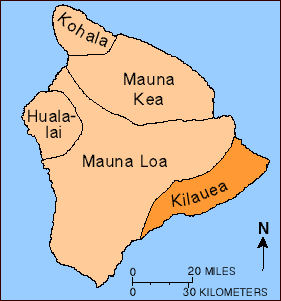
In October 2000 I took an extended trip to re-visit the Kilauea volcano:
in Hawaii.
I stayed at the Volcano House:
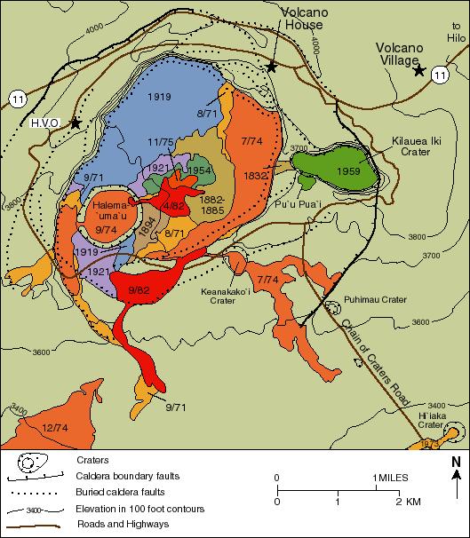 (credit USGS)
located within the Hawaii Volcanoes National Park:
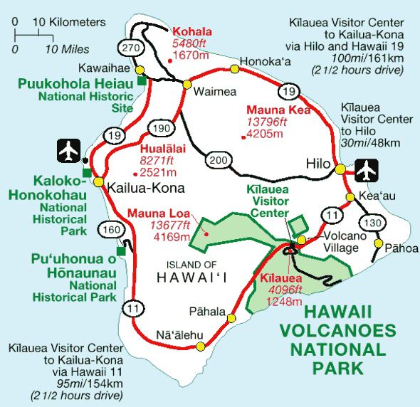 (credit HNP)
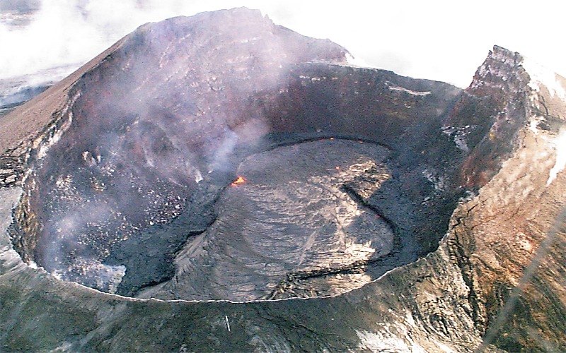
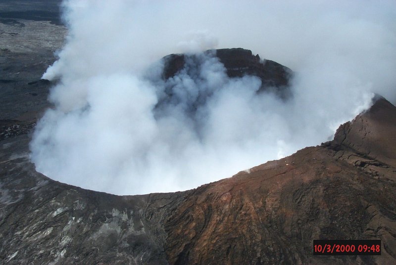
Much of Kilauea's eruptive activity occurs at Pu`u `O`o, the large cone and lava lake on the side of the Kilauea volcano:
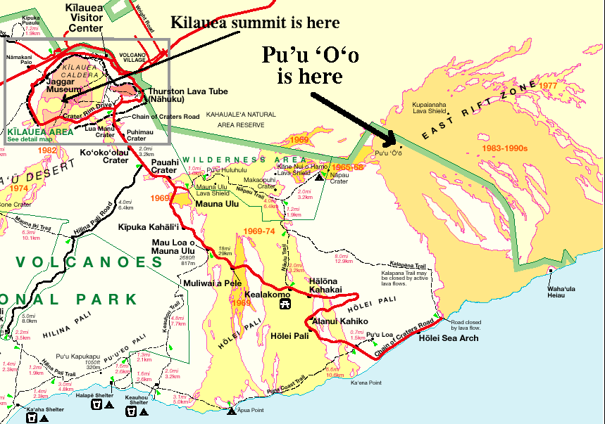 (credit HNP)
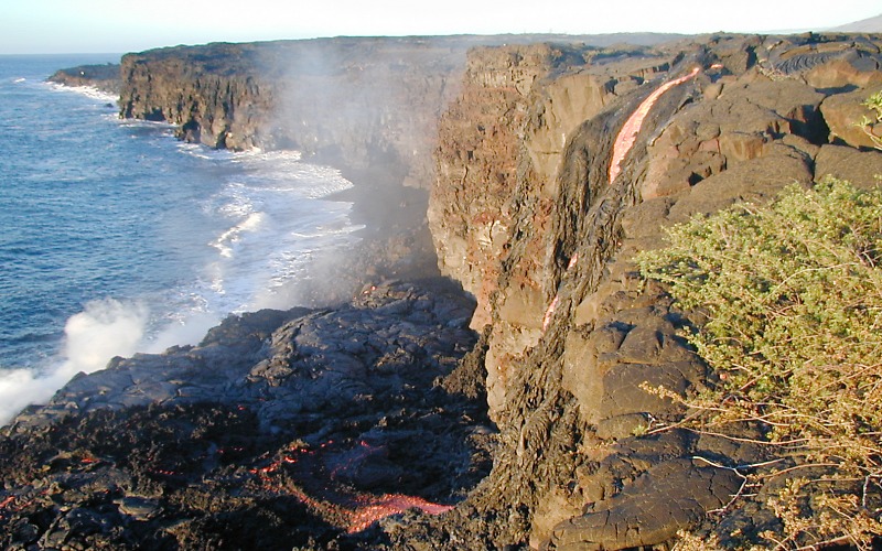
From Pu`u `O`o the lava flows in tubes and sometimes above ground down to and under the ocean:
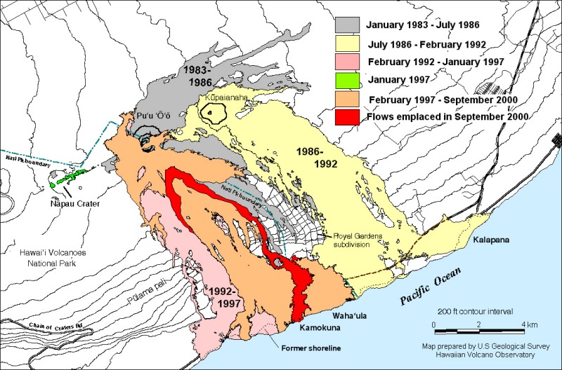 (credit USGS)
Note that the red part was the active flows while I was there.
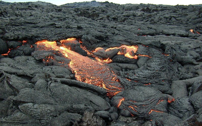
Several times I took the 3.5 mile (~5 km) trip overland to reach the lava flows where they were flowing into the ocean. Walking over the lava fields was a extremely strenuous, particularly at night. While overall the ground may be flat, the Pahoehoe flows result very awkward walking:
 (credit USGS)
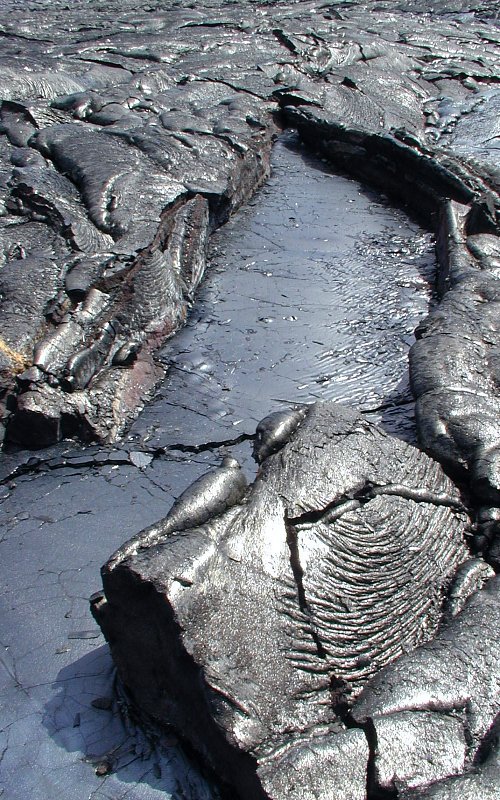
It was not unusual for the ground to go 6 feet (2m) up and then 12 feet (4m) down and 6 feet (2m) back up in a short vertical distance span of 24 feet (6m). Sharp rocks with a glassy coating:
 (credit USGS)
was the norm. One had to watch were you stepped: :-)
 (credit USGS)
The 7 mile (~10 km) round trip took about 5 hours in the daytime, and about 6 hours at night.
Here is mini cone above is about 18 feet (6m) high:
 (credit USGS)
Here is an example of the Pahoehoe flow, with the crater of Pu`u `O`o (the major lava lake on the side of Kilauea) in the background:
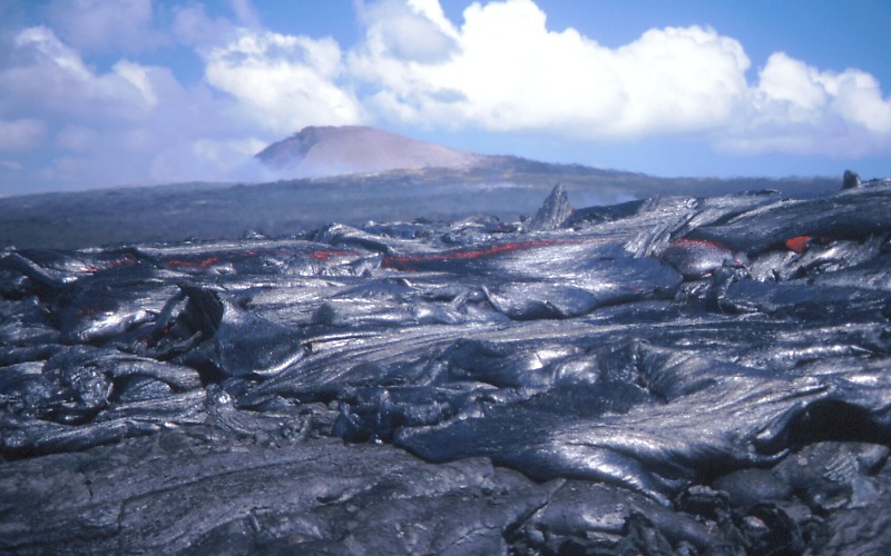 (credit USGS)
Here is another example with an active above ground flow on the left and older (1997) flow on the right:
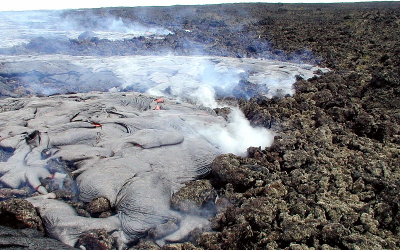 (credit USGS)
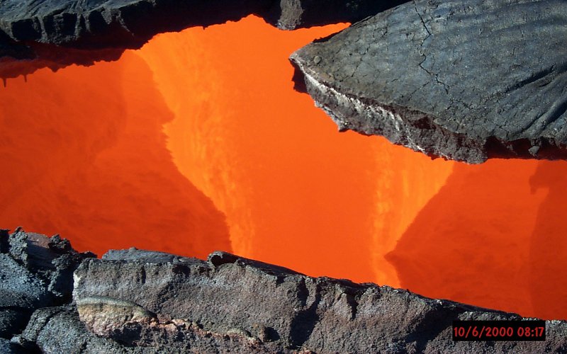
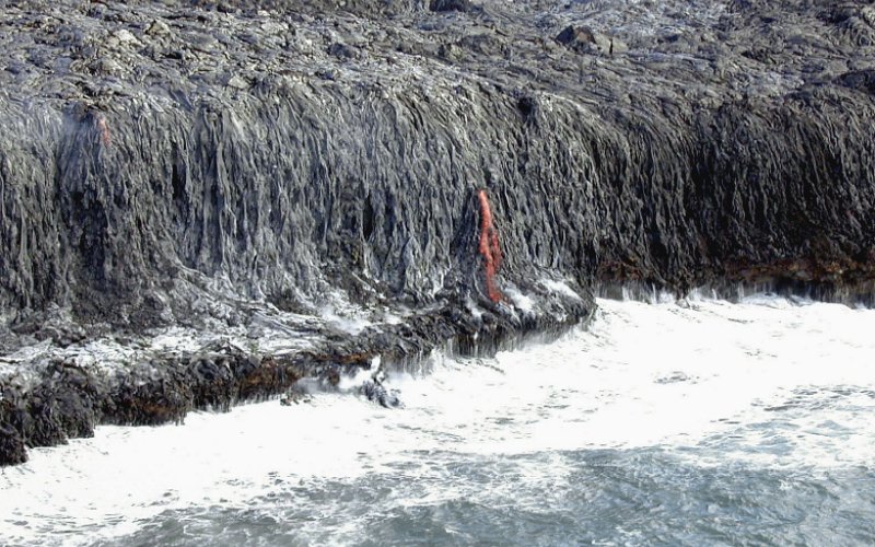
In the day time, most of the lava flow is silver or silvery-blue. This is because lava quickly cools and hardens when it comes into contact with the air. The ``Red stuff'' is mostly shows up at nighttime or when there are great lava fountains are shooting, or at the edge of a flow, or when lava tubes break open (i.e., skylight):
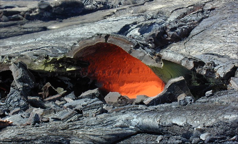 (credit USGS)
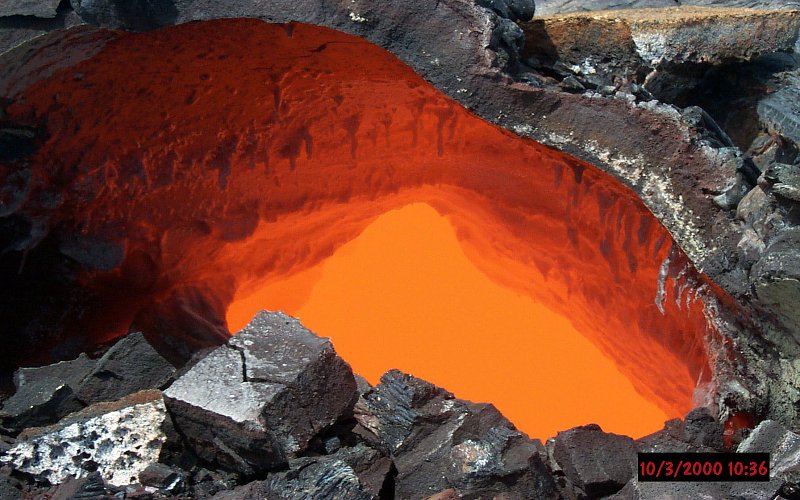 (credit USGS)
The above skylight was a wonderful sight. It was hard to get to, being farther up the slope, but the climb and heat was worth the effort.
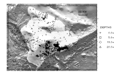
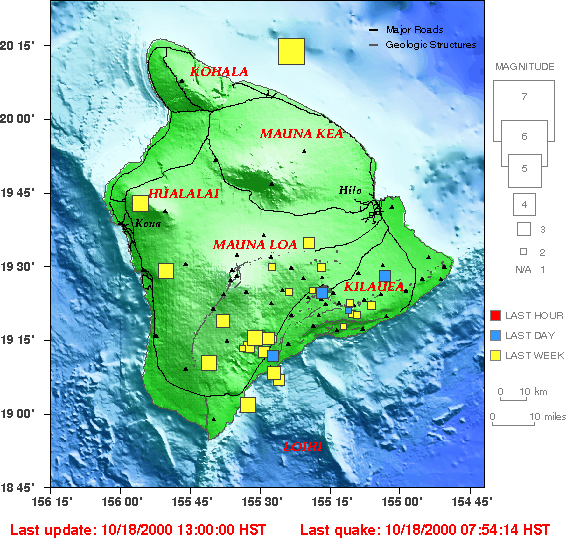
We had lots of fun quakes:
 (credit USGS)
 (credit USGS)
Most of them is tiny ones, but once in a while a larger one hit. The largest I felt was about Mag 4.
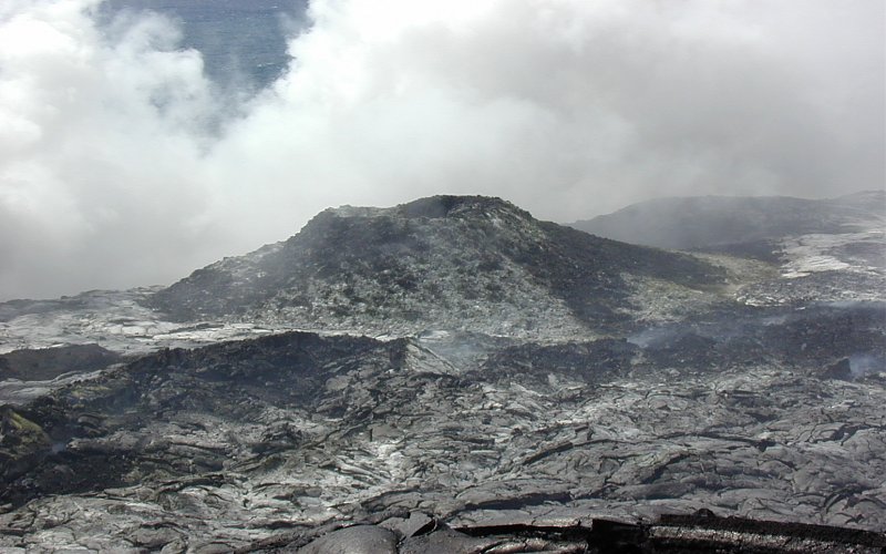
The trip up to Pu`u `O`o was done by helicopter:
 (credit USGS)
 (credit USGS)
Pu`u `O`o is about 820 feet (250m) by 1312 feet (400m) in area. It is about 390 feet (119m) high.
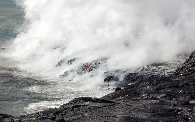
Most of my nighttime and daytime trips were along the sea coast near Kamokuna (see the maps above):
 (credit USGS)
 (credit USGS)
 (credit USGS)
where the lava is pouring into the ocean.
Landon Curt Noll
chongo <was here> /\oo/\
![]()